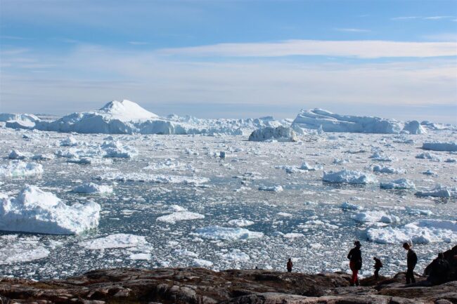
As climate change advances, the vast bodies of ice on Antarctica and Greenland contribute significantly to sea level rise. To project their future effect on sea level rise, additional research is required to improve scientists’ understanding of these masses of ice. Now, two groups of scientists are undertaking a joint effort to address what has long been a major obstacle to such research.
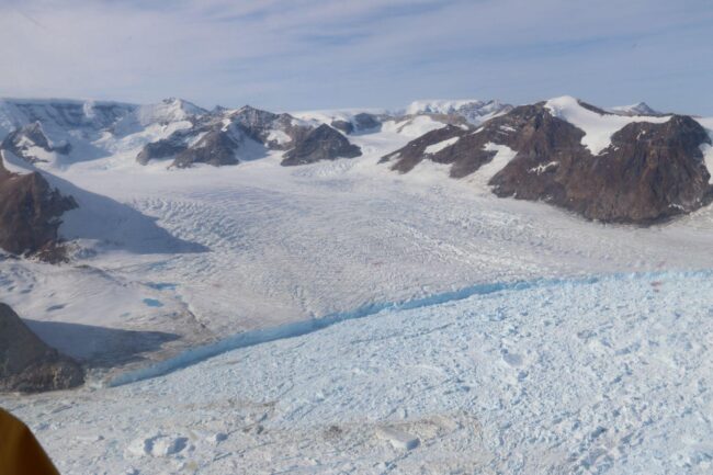
These bodies of ice are composed of two sections: the vast ice sheets that cover the interior of Greenland and Antarctica, and the peripheral glaciers at the ice sheets’ edges. These peripheral glaciers, like glaciers elsewhere in the world, carry ice downslope to lower elevations. In these cases, they release icebergs into the ocean. The meltwater from these icebergs is a large and growing source of sea level rise. Both the ice sheets and the glaciers must be carefully studied to carry out what Joerg Schaefer, a glaciologist at Columbia’s Lamont-Doherty Earth Observatory, calls “a key goal of cryospheric science around the world: understanding estimates of near-future polar ice melt, and thus of sea level rise.”
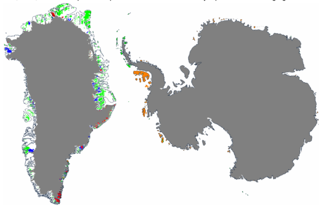
The scientists who study the ice sheets and those who focus on peripheral glaciers often work independently, but the regions they study sometimes overlap. In other cases, some glaciers are excluded from both groups. This means estimates of sea level rise from Greenland and Antarctica may have some small amount of double-counting or missing mass loss. As Schaefer told GlacierHub, “The Intergovernmental Panel on Climate Change reports do their best to coordinate the ice sheet and glacier estimates, but errors remain large.”

The communities of ice sheet researchers and glacier researchers are now working together to improve estimates of sea level contribution from these two components. This effort is organized as a working group of the International Association of Cryospheric Sciences (IACS), led by Ken Mankoff, a geoscientist at NASA and Fabien Maussion, a glaciologist at the University of Bristol.
The problem that they are seeking to address is the lack of coordination between research on the Greenland and Antarctic ice sheets and on the peripheral glaciers of the ice sheets. The definitions of the main ice sheets and peripheral ice bodies in Greenland and Antarctica are not uniformly recognized across diverse groups and stakeholders. Though it may seem trivial, the challenge of establishing and agreeing upon consistent geographical and hydrological boundaries between the different ice masses is highly challenging. Each interested community (e.g., observations, remote sensing, modeling) and domain (e.g., ice sheets, peripheral glaciers) often uses distinct boundaries.
These inconsistencies introduce errors in estimation of mass loss and sea level rise. In Antarctica, a <2 % difference in the estimate of the ice sheet area can lead to a >5 % error in surface mass balance estimates. The errors are likely larger in Greenland, because surface melting during warm summer months creates complex changes at the ice sheet’s edges.
One scientist facing these difficulties is Jacqueline Austermann, a geoscientist at Columbia’s Lamont-Doherty Earth Observatory. In an interview, she told GlacierHub, “In my research group, we are modeling sea level change in response to future Greenland ice mass change. We are trying to make sure that both peripheral glacier and ice sheet changes are included correctly without overlap or gaps, but it’s not always obvious that this work has been done. This has made us wonder how much communication there is between these communities of researchers. It’s great to see this effort from the IACS.”

Mankoff, Muassion and their colleagues are addressing these issues. The group’s work can be followed on GitHub, where volunteers can also register to participate. Their first goal is to understand the tools, known as masks, which researchers use to classify sections of satellite images into ice and non-ice. The group is examining the different ice masks used by different communities, documenting their usage, and exploring the questions involved from each group should their mask change. Future work will select a ‘best true’ outline of the ice sheets from recent remote sensing imagery, and then provide various geospatial data products derived from that in the formats and at the resolutions needed by each community.
This group effort faces challenges, since it relies on the unfunded work of volunteers. For example, the ‘best true’ outline might contain some errors, or it might be a coarse description that would miss some fine-grained details. Moreover, the ice sheets and glaciers are constantly changing. As a result, any product that the group generates will soon be out-of-date and require revisions. Still, the benefits of a coherent and agreed-upon definition of the ice sheet boundary—even if imperfect—will improve the ability to quantify the rates of mass loss from the ice sheets and to estimate future sea level rise.
To learn more about the project, visit IACS. The proposal, recordings of meetings, and all work that is not on GitHub can be found here.
Ken Mankoff is a geoscientist, senior scientific programmer at NASA’s Goddard Institute for Space Studies and an adjunct senior scientist at the Geological Survey of Denmark and Greenland.


No Comments
Leave a comment Cancel